Weather Bee | Skewed rain responsible for Himachal and Uttarakhand floods
One reason why parts of Himachal and Uttarakhand have flooded this monsoon is that there was a big surplus on particular days.
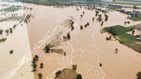
Parts of Himachal Pradesh (HP) and Uttarakhand flooded due to intense rain in the past week. This has also happened earlier in the season. Does this mean that there is a big surplus of rain this monsoon in these states? An HT analysis of India Meteorological Department’s (IMD) gridded data shows that this is not necessarily the case. In fact, HP has a deficit. The reason for the floods, data shows, is that rain so far has often been concentrated in particular parts of the season and particular parts of these states.

It is not unusual to expect a big surplus in rain when there are floods due to it. However, for the monsoon season overall – it begins officially on June 1 – only Uttarakhand has a surplus among the two states. The state has a surplus of 27%, which is classified as “excess” by the IMD. However, Himachal, which has also been affected by floods, has a deficit of 26%, which is classified as “deficient” by the IMD. Clearly, the overall performance of the monsoon season cannot explain the disasters in these states.
One reason why parts of HP and Uttarakhand have flooded this monsoon is that there was a big surplus on particular days. This can be seen from the rainfall trends in individual months and days. Himachal, for example, had a deficit of 46% and 27% in June and July but has a 12.5% surplus in August so far. Even this surplus would not have been possible without the 33 mm rain the state received on August 1. This is more than half the rain the state has received this month. In fact, the state also received a similar amount of daily rain on July 6 (26 mm) but ended up with a deficit in the month because other days of the month were unusually dry.
Uttarakhand has also received a big surplus of rain on particular days this season. This has also happened on more days in Uttarakhand than in Himachal Pradesh. This is why the state had a deficit only in June. In July, it had a surplus of 56%; and it has a 15% surplus so far this month. However, as the accompanying chart shows, the surplus in even these months has been built due to unusually high rain on particular days.
To be sure, in absolute terms, neither HP nor Uttarakhand has averaged more than 47 mm rain on any day of the season. If this amount was evenly spread across the state (meaning all places received 47 mm rain), the chances of floods would be lower. However, rain is hardly spread evenly over a large region. Therefore, the geographical concentration of surplus rain also has a role to play in the floods in the two states. This can be seen from the accompanying map. While the northern half of Uttarakhand has received a big surplus in August, parts of its southern half have big deficits. Similarly, only the southwestern parts of Himachal Pradesh have a surplus this month.

The trends seen in August in the two hilly states can also be seen for the season before August. For example, the southwestern parts of Himachal Pradesh were not deficient in either half of July even though the state did. Similarly, the excess rain in Uttarakhand in different parts of the season was due to excess rain in only parts of the state.

While this analysis is limited to the most recent occurrence of floods, similar trends can be seen in relation to other disasters. One big example is Assam, which has just an 11% surplus right now despite being ravaged by floods early in the season. This highlights how the overall performance of the monsoon is not tied to the occurrence of rain-related disasters in the ongoing monsoon season.
Abhishek Jha, HT’s assistant editor-data, analyses one big weather trend in the context of the ongoing climate crisis every week, using weather data from ground and satellite observations spanning decades.
Continue reading with HT Premium Subscription


